
Eagles Flourish on KDD Lands

The information from this page is from a flier available at the Klamath Drainage District business office created by former District Manager, Joe Frost. To pick up a printed version for your Klamath basin bird watching needs, you can stop by 4240 Highway 39, Klamath Falls, OR 97603 (next to Klamath Basin Equipment) to grab one.
History
The Klamath Drainage District was created on March 6, 1915 as part of the Bureau of Reclamation’s Klamath Project. In addition to water rights provided under contract with the USBR, in 1977, KDD was granted a water right by the State of Oregon that allows it to irrigate from October 1 to March 1.
Winter flooding simulates how the area operated prior to the construction of the railway levee which severed the natural flooding of the Lower Klamath Lake from the Klamath River. The lakebed was filled during the winter months in high flow events and would drain as flows receded in the spring.
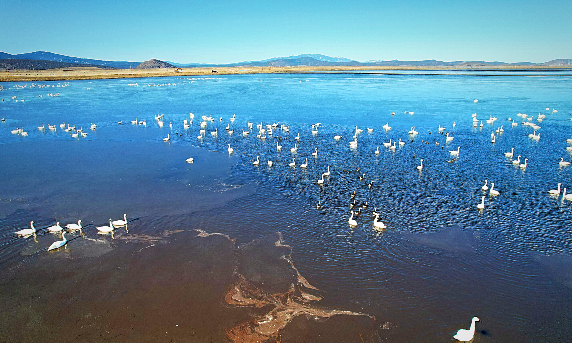
This winter flooding is intended to restore soil moisture in preparation for seed germination, but it has also proven to provide immeasurable environmental benefits. The irrigation and farming practices within KDD create thousands of acres of wildlife habitat providing the optimum use of both land and water resources.
Environmental Benefits
KDD delivers water to the United States Fish and Wildlife Service, via the ADY Canal system, and provides drainage which must be done through District facilities.
Wildlife from the adjacent refuges and habitat areas utilize lands throughout KDD. This is especially true during the winter months when KDD landowners flood their fields.
In 1996, KDD hired SRI/SHAPIRO/AGCO, Inc. to do an independent biological survey on lands within KDD. The greatest number of wildlife observations were recorded in areas where field crops were grown. These lands were used by wildlife year-round. Pasture and flooded pasture were found to be another heavily-used habitat type supporting waterfowl and more than 50 other bird species for 10 out of 12 months.
SRI/SHAPIRO/AGCO concluded: “The agricultural activities within the KDD service area provide important seasonal forage habitat for migrating waterfowl and wintering eagles. A key factor in the use of land within the KDD service area by certain species of wildlife (for example, mallards, pintails, and bald eagles) appears to be the practice of winter flooding, which creates extensive shallow, open-water habitat. The combination of open water and agricultural fields containing grain, vegetable matter, and other forage within the KDD service area is the key element providing seasonal waterfowl habitat . . . Flood irrigating fields also provides foraging and diurnal resting habitat for waterfowl, and forces montane rodents to the surface, creating a forage base for eagles.
“Changes in the current management of lands within the KDD service area may result in changes to the number of species and individuals in the area. Elimination of, or reduction in, flood irrigation during key seasonal periods would be expected to reduce overall waterfowl numbers.”
Because of the Basin’s relatively mild climate and reliable and abundant food resource, the area supports the largest wintering population of bald eagles in the continental United States. Primary prey base for wintering eagles in the Klamath Basin is waterfowl and small mammals, according to R.W. Frenzel (1985). Forage areas for the eagles include privately-owned lands and government managed wildlife refuges.
In documenting bald eagle use of KDD lands, Keister et al., (1983) refer to the area serviced by KDD and the Klamath Game Management Area immediately to the west, as the “Oregon feeding area”. Bald eagles that roost at the Bear Valley National Wildlife Refuge roost site use the Oregon feeding area extensively in winter. (Keister, et al., 1987)
The highest estimates of the population occurred during the second week in January and the first week of February. (Keister et al., 1987) This time frame coincides exactly with the time frame the KDD landowners are engaged in winter flooding practices.

Location
The Klamath Drainage District (KDD) services approximately 27,000 acres consisting of agricultural lands and wildlife refuge areas. The District is located along Highway 97, approximately 14 miles south of Klamath Falls, Oregon. The District’s southern border is the Oregon/California state line. KDD is bounded on the east by the Lower Klamath Lake Road.
KDD is surrounded by abundant natural resources. To the west lie the Klamath Game Management Area, Tule Smoke Gun Club and the Bea Valley NWR (eagle roosting refuge), all of which provide wildlife habitat. Within the KDD service area, and directly across the state to the south, are Lower Klamath National Wildlife Refuge lands.
Helpful Hints
Best time of year to spot eagles on KDD lands: Early January through the first week of February.
Best places within KDD to spot eagles: Along Township Road, Stateline Road, and Lower Klamath Lake Road.
References
Frenzel, R.W. 1985 Environmental contaminants and ecology of bald eagles in south-central Oregon. Ph.D. Thesis, OSU, Corvallis, OR
Keister, G.P., R.G. Anthony. 1983. Characteristics of bald eagle communal roosts in the Klamath Basin, Oregon and California. Journal of Wildlife Management 47:1072-1079
Keister, G.P. Jr., R.G. Anthony, E.J. O’Neill. 1987. Use of Communal Roosts and Foraging Areas by Bald Eagles Wintering in the Klamath Basin. Journal of Wildlife Management. 51(2):415-420
SRI/SHAPIRO/AGCO, Inc. (A. English, E.J. O’Neill, W. Lind) 1998. Initial report on investigation of wildlife resources on lands within the Klamath Drainage District’s service area.